


介绍 Trekarta - offline maps for outdoor activities
Trekarta is designed for hiking, geocaching, off-roading, cycling, boating and all other outdoor activities. It uses offline maps so you do not need to have internet connection. You can easily import places and tracks from GPX and KML data formats or create places in application and share them to others. It lets you write the track of your journey, even in background, so you will never get lost and be able later see where you've been.
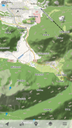
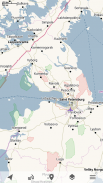
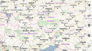
Offline maps
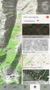
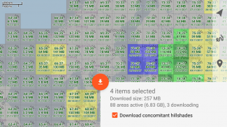
Trekarta uses OpenStreetMap based vector maps that are lightweight, offline and are constantly enhanced by contributors. Maps contain detailed topological data with elevation contours. Some map elements can be filtered out for cleaner look. Trekarta has built-in hillshades support. You can add custom maps in sqlite or mbtiles format to cover your area of interest. Custom maps will be shaded as well. Such maps can be created by yourself with SAS.Planet application from mostly any online source or converted with MapTiler and other applications from other map formats.
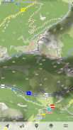
Hiking
Special hiking activity mode emphasises paths and tracks on map. It visualizes path difficulty and visibility and displays hiking routes. It also displays special OSMC symbols that help you identify desired route.
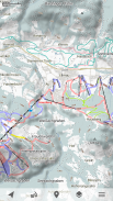
Skiing and skating
Skiing activity mode displays clean winter map with mostly all skiing activities: downhill, nordic, hiking and touring. As a bonus freestyle snow-boarding, skating and sleighing areas are displayed.
Off-road
Unpaved, dirt, winter and ice roads are specially visualized. 4wd only roads have specific marking. Fords are displayed on all roads, even primary.
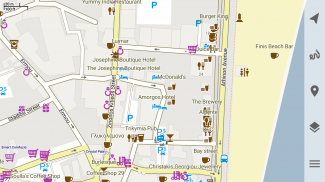
Places
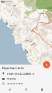
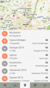
Places can be easily imported from GPX and KML files or can be created within application. You can navigate to places and share them with others.
Tracks
Trekarta is designed to record tracks of your journey. Simply press a button when you start and press it once more when you finish. You can quit the application if you do not need to look at the map, the track will be recorded in the background.
Plugins
Trekarta functionality can be extended by plugins. Currently the following plugins are available:
• Location sharing
• Dropbox sync
More info
More information can be found at:
https://andreynovikov.info/tag/trekarta.html
Questions can be asked at:
https://groups.google.com/d/forum/trekarta
Trekarta 专为远足,寻宝,越野,骑自行车,划船和所有其他户外活动而设计。它使用离线地图,因此您无需连接互联网。您可以轻松地从GPX和KML数据格式导入场所和轨道,或在应用程序中创建场所并将其分享给其他人。它可以让你编写旅程的轨迹,即使在背景中也是如此,所以你永远不会迷路,以后能够看到你去过的地方。
离线地图
Trekarta使用基于OpenStreetMap的矢量地图,这些地图是轻量级的,离线的,并且不断由贡献者增强。地图包含具有高程轮廓的详细拓扑数据。可以过滤掉一些地图元素以获得更清晰的外观。 Trekarta拥有内置的山体阴影支持。您可以添加sqlite或mbtiles格式的自定义地图来覆盖您感兴趣的区域。自定义地图也将以阴影显示。这些地图可以由您自己使用SAS.Planet应用程序从大多数在线源创建,或使用MapTiler和其他地图格式的其他应用程序转换。
徒步旅行的
特殊的徒步活动模式强调地图上的路径和轨迹。它可视化路径难度和能见度,并显示远足路线。它还会显示特殊的OSMC符号,帮助您识别所需的路径。
滑雪和滑冰
滑雪活动模式显示干净的冬季地图,主要是所有滑雪活动:下坡,北欧,远足和旅游。作为奖励自由式滑雪板,显示滑冰和雪橇区域。
越野
未铺砌,泥土,冬季和冰路都是特别可视化的。 4wd只有道路有特定的标记。福特显示在所有道路上,甚至是主要道路上。
的地点的
可以从GPX和KML文件轻松导入位置,也可以在应用程序中创建。您可以导航到地点并与他人共享。
曲目的
Trekarta旨在记录您的旅程。只需在开始时按一个按钮,完成后再按一次。如果您不需要查看地图,则可以退出应用程序,轨道将记录在后台。
插件的
插件可以扩展Trekarta功能。目前有以下插件可用:
•位置共享
•Dropbox同步
更多信息
更多信息可在以下网址找到:
https://andreynovikov.info/tag/trekarta.html
可以在以下位置询问问题:
https://groups.google.com/d/forum/trekarta
Trekarta - offline maps for outdoor activities - 版本2023.11
(30-11-2023)
Trekarta - offline maps for outdoor activities - APK信息
APK版本: 2023.11程序包: mobi.maptrek同类应用
您可能还会喜欢……


